- Published in Activities
- Read 5390 times
- Written by MAEU
- Print , Email
Activities of Department of UAV Research, MAEU
Sustained Efforts to Expand Partnerships with National and International Organizations
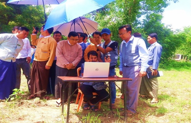
1. Collaboration with FAO for agriculture damage assessment used in UAVs mapping of flood area in Magway Region
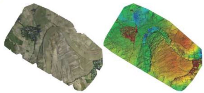
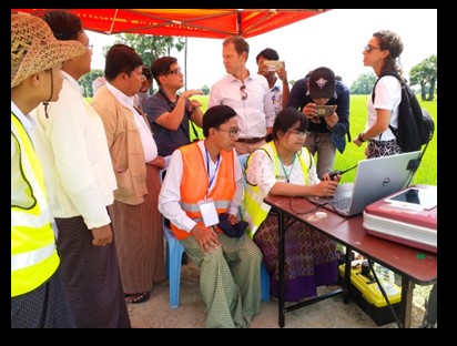
The department of UAV Research, MAEU cooperated with UN-FAO since 2016 in generating the applied map for agricultural damage assessment of the area affected by flood disaster in Magway Division Region. Then, the applied mapping of the pre-disaster management was generated for the along of Mone-Chaung, Mann-Chaung branches of Ayeyarwady River by using the UAVs of our department.
2. Collaboration with UN-FAO for landslide damage assessment in Haka Town using UAVs System
In 2017, The department of UAV Research cooperated with UN-FAO in order to generate pre- and post-landslide mapping for landslide damage assessment in Haka Town, Chin State by using UAV drones. And then, the UAV aerial mappings of landslide affected regions in Kale Township, Sagaing Division Region were submitted to the responsible departments and ministries of Myanmar.
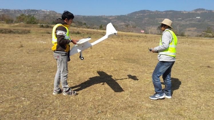
3. Collaboration with UN-FAO and MOALI for Four Drones Supporting & Task Force Training
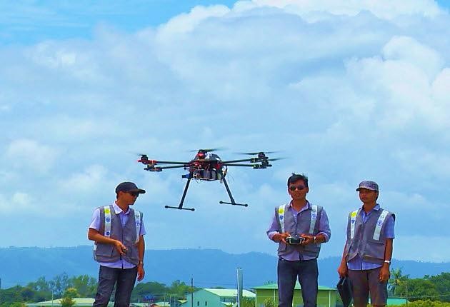
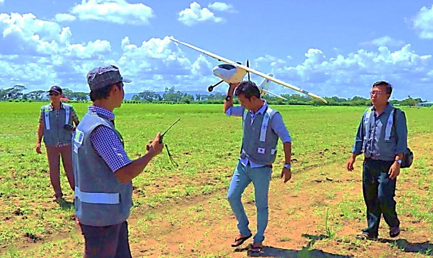
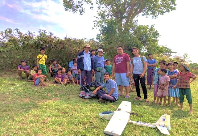
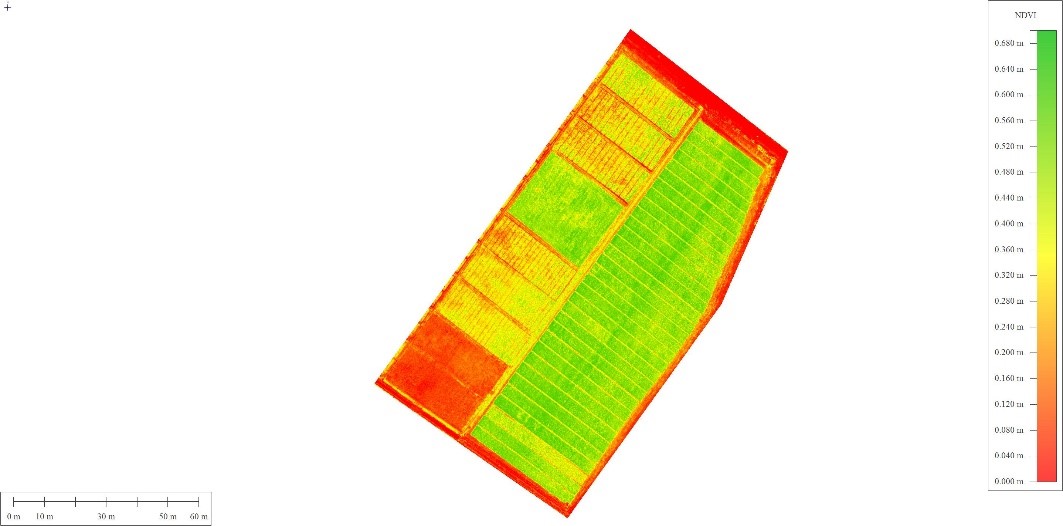
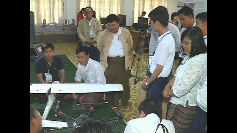
The department of UAV Research of MAEU, Ministry of Agriculture, Livestock and Irrigation Myanmar and FAO carried out altogether for upgrading agricultural techniques using drones. Two Fixed-wing UAVs for surveying agriculture areas and two NDVI UAVs for monitoring vegetation growth health were researched and transferred to MOALI. Besides these, the thirty officers from Department of Agriculture and Irrigation Department of MOALI had been trained on Drone Pilot Training, Generating Mapping Training and generating the applied mapping for vegetation growth health assessment Training by our department. The application of UAVs on agriculture was demonstrated to the higher officers from ministries.

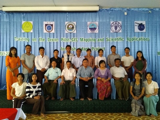
4. Training on Drone Pilot, GIS Mapping and Scientific Application for Fish Adapt Project
In 2019, The UAV Research department of MAEU, FAO and Department of Fisheries of MOALI cooperatively performed in generating applied aerial mapping in order to implement the project (Fish Adapt Project) on fisheries which fills up strengthening on fisheries for adaptation and resistance to the weather in Yangon Region, Ayeyarwady Region and Rakhine State. The office staff and officers from department of fisheries, MOALI had been already trained on the generating applied aerial mapping training and generating applied GIS Mapping high performance training by the UAV department.
5. Collaboration with JAICAF and DoA for Crop Monitoring Project
The UAV Research department of MAEU, the department of agriculture (DOA) of MOALI and the professional experts from Japan Association for International Collaboration of Agriculture and Forestry (JAICAF) cooperatively performed and generated the aerial mapping for disease assessment of crop and vegetation by using drone mounted with the Infrared sensor in Aung Lan Town, Magway Region.
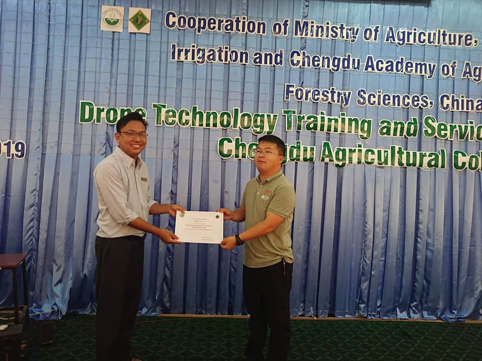
6. Collaboration with Chandu Agriculture University and DoA for Training on Precision Agriculture
The UAV Research department of MAEU, the department of agriculture (DOA) of MOALI of the Republic of Myanmar and Chandu Agriculture University, Sichuan State, the Republic of China cooperatively performed the training on the monitoring of growth assessment of crops and vegetation using UAV drones.
7. Collaboration with DOA -Bagan & UNESCO expert for 2016 Bagan Earthquake Damage assessment
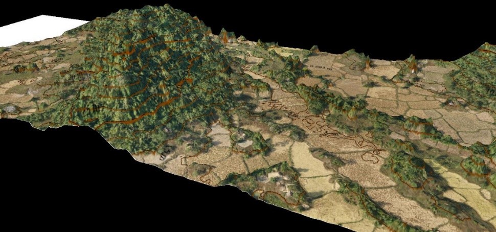
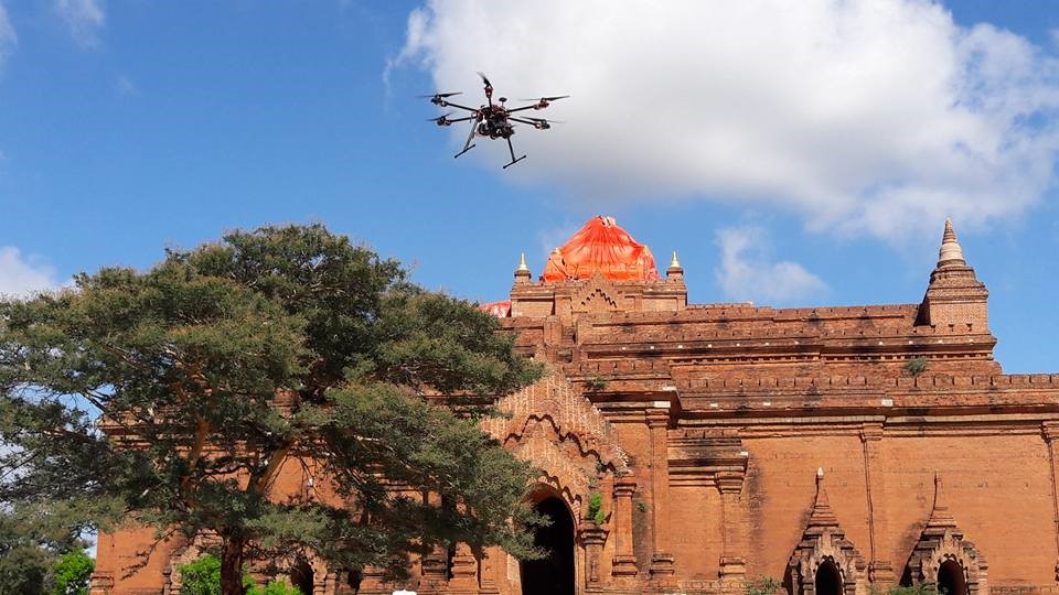
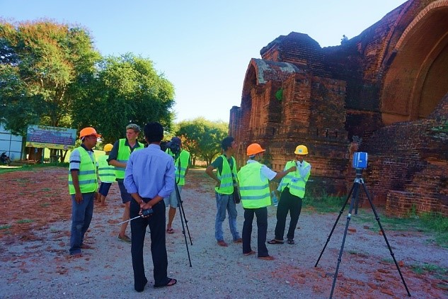
The UAV Research department of MAEU, the Department of Archeology (DOA-Bagan) of The Ministry of Religious and Culture Myanmar and the professional expert (archeologist) from UNESCO cooperatively researched and worked on the generating 3-D models of 42 damaged Pagodas and Temples in Bagan Town struck by earthquake in 2016.Also we supported UAV aerial Survey for the map of Bagan Region (42 sq.Km).
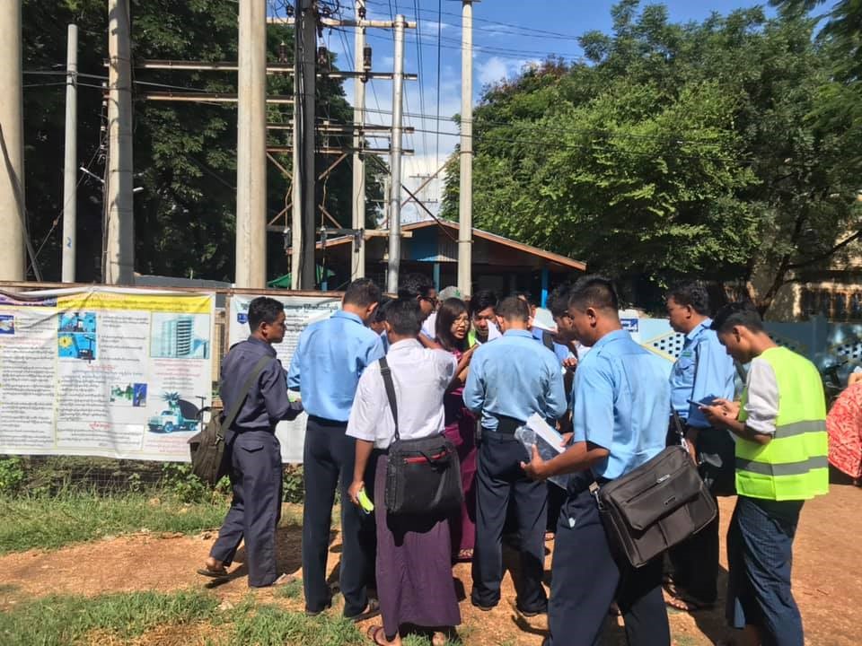
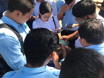
8. Technical cooperation with World Bank for Myanmar Power Map Project
The UAV Research department of MAEU, Ministry of Electricity and Energy (MOEE) Myanmar and World Bank cooperatively implemented the Myanmar Power Map (MPM) Database by the use of GPS (GIS) Georeferenced Information System for generating the location map of the 33 and 11 KV electrical power transmission line in Sagaing and Ayeyarwady Regions in 2019. The MPM Electrification Network Database becomes the essential supporting for the project of National Electrification Project (NEP) which is to supply the electricity for the whole country of Myanmar in 2030. And then, the upgrading and maintaining of the electricity supply enterprise can be supported by the application of the MPM Database.
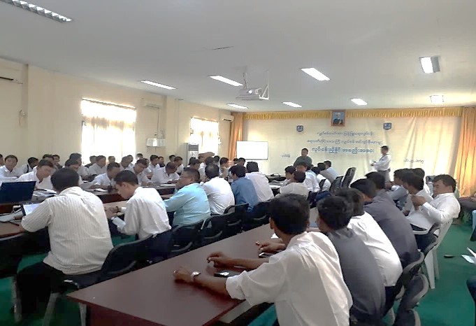

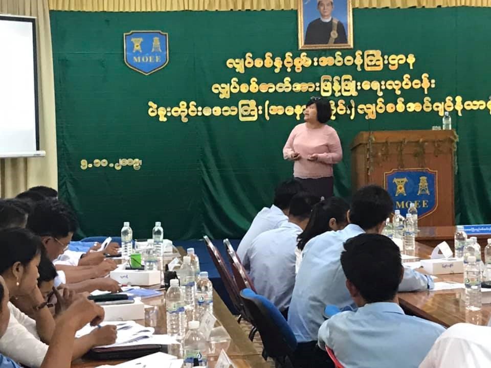
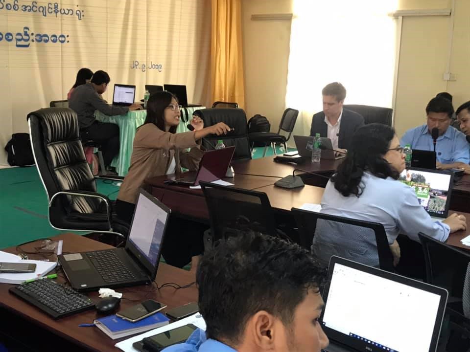
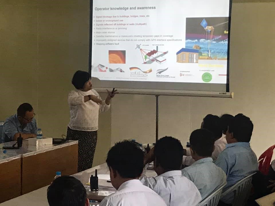
9. Collaboration with GIZ for Training Services on Data Collection and Data Analysis of Geographic Information System for Electrification Network of 12 Regions/ States in Myanmar
Department of UAV Research, Myanmar Aerospace Engineering University collaborated with the GIZ (part of the German Development Cooperation) for Training Services for Data Collection and Data Analysis of Geographic Information System -
- The primary training objective is to train MoEE and DRD officials for working in the field and to be enable them for using the GIS tools including GPS data collection equipment and Quantum GIS (QGIS) software
- To build a Myanmar Power Map using Digital tool for existing Electrification Network of MoEE and DRD in each 12 Regions / States
- The Project is to support the preparation of the universal access plan the National Electrification Project (NEP) the Government of Myanmar is spearheading a large-scale rural electrification initiative to provide universal access to electricity by 2030
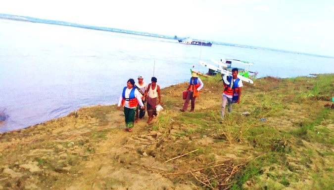
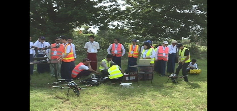
10. Collaboration with UN-FAO and DDM for Disaster Management using Drone Aerial Survey Mapping
The MAEU UAV department, Department of Disaster Management of Ministry of Social Welfare, Relief and Resettlement Myanmar, Food and Agriculture Organization of the United Nations (FAO) cooperated for the training on Drone Pilot Training for searching and rescuing while striking the disaster and for generating aerial map of disaster management. Besides these, our department helped the generating aerial map of damage areas due to flood in Magway Region.
Contact Information:
Please send any questions to This email address is being protected from spambots. You need JavaScript enabled to view it. with your name, email address, and telephone/mobile number.
Latest from MAEU
- မြန်မာနိုင်ငံလေကြောင်းနှင့်အာကာသပညာတက္ကသိုလ် ဒုတိယအကြိမ်မြန်မာ့ရိုးရာထမနဲထိုးပြိုင်ပွဲကျင်းပ။
- မြန်မာနိုင်ငံလေကြောင်းနှင့်အာကာသပညာတက္ကသိုလ် မိုးရာသီအားကစားပြိုင်ပွဲ ဆုပေးပွဲအခမ်းအနားကျင်းပ
- မြန်မာနိုင်ငံလေကြောင်းနှင့်အာကာသပညာတက္ကသိုလ်မိသားစု ဝါဆိုသင်္ဃန်းကပ်လှူပူဇော်။
- မီးဘေးအသိပညာပေးဟောပြောခြင်းနှင့် မီးသတ်ဆေးဗူးမှန်ကန်စွာအသုံးပြုနည်း သရုပ်ပြခြင်း။
- လေကြောင်းနှင့်အာကာသဆိုင်ရာ ပြခန်းဖွင့်ပွဲနှင့် ကမ္ဘာ့ပထမဆုံး အာကာသယာဉ်မှူး ယူရီဂါဂါရင်ရုပ်ထု လွှဲပြောင်းလက်ခံပွဲ အခမ်းအနားကျင်းပခြင်း